Welcome to ""Jacksonville on Foot"

Jacksonville is the largest city in the State of Florida and the city with the largest geographical area in the contiguous United States. Jacksonville has a rich history enhanced by it's proximity to the St. Johns River and the Atlantic Ocean with weather that makes it easy for people to explore the city on foot whether it is a more remote wilderness hike or a leisurely stroll in the downtown core. Visit "Jacksonville on Foot" often to get ideas for your next adventure.

Thursday, October 20, 2011

New Berlin & Yellow Bluff to The Early Spot in Oceanway

Sometimes you just want to go for a walk in your own neighborhood but mix it up a bit. This is the perfect opportunity for getting up close and personal with the area where you live and have a better picture of what is really going on close by.

One afternoon a few weeks ago I decided to walk to a coffee/sandwich shop that recently opened in a strip mall a couple of miles from the house. I had been there before and wanted to go back to try something different.

The neighborhood I left behind when I moved to Jacksonville from Seattle had an awesome mix of small businesses within easy walking distance, and I always make an effort to support independent businesses as much as possible. They give our communities character. 


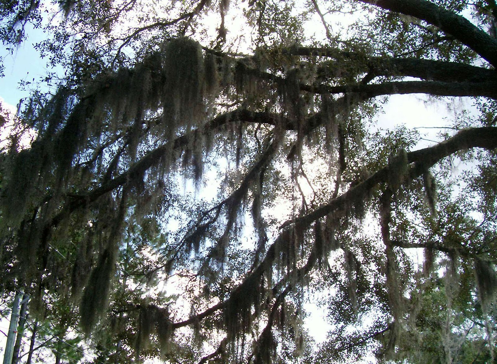
Spanish Moss Draped Oak Trees

My neighborhood does not have a stellar walkability score, but I try to make the best of the cards I am dealt, so I set out with my camera in hand on my way down the street.


Distance:
  • 3.25 miles (out & back)
Terrain:
  • Sidewalks & road shoulders.
Amenities:
  • Well-traveled road suitable for walking alone, convenience stops available for beverages & snacks or a full meal, chance to admire newer housing developments & interesting landscaping.
Pets:
  • Leashed according to city ordinances. Be a good neighbor and bag waste.
Wheelchairs:
  • Not a suitable means of transportation to The Early Spot, but part of the route is a good outing.
Modifications:
  • Tour housing developments with a low traffic profile off Yellow Bluff Road & Alta Road.


The Walk

  • Let's just say for the purposes of this blog that I started my walk at Walgreen's at the intersection of  New Berlin Road & Yellow Bluff Road. Actually, it was a farther distance away, but I choose not to disclose my home address on the internet. I am sure you understand.
  • I followed Yellow Bluff Road heading south toward Faye Road & 9A taking time to admire the nicely landscaped entrances to housing developments as I walked along.


Beautiful Landscaping

Stunningly Colorful Coleus

  • Eventually, I came to one of my favorite points of the walk...a bridge crossing over a beautiful estuary that is a tributary of the St. Johns River. It is possibly part of Dunn's Creek. I had been walking on the east side (left) of Yellow Bluff Road and crossed over to the west side because the sidewalk was ending. There is a pedestrian walkway over the bridge creating a safety barrier from traffic on both sides, but there is some overhanging vegetation on the east side that is a bit annoying. I did take photos looking toward the east before crossing to the west side. The views from the bridge are awesome!


Estuary on Yellow Bluff Road

  • Past the bridge, Yellow Bluff Road become Alta Drive. There is a large industrial park called NorthPoint located on Port Jacksonville Parkway that cuts through to a quite rural section of New Berlin Road. The walk can easily be extended at this point for a really long workout, but I continued along Alta Drive. The route takes on a more wooded look from here to where The Early Spot is located. There are more beautiful plants and trees.


Wooded Lot on Alta Drive


Pampas Grass

  • Pampas Grass lines the border of the yard where the sidewalk ends, but I was able to continue walking along the wide shoulder for awhile. This put me in the vicinity of Aldersgate Road. The shoulder does get more narrow before arriving at The Early Spot, so I eventually crossed to the east side to be safely facing traffic for a short distance until I got there. Traffic can be heavy here because there are on/off ramps for 9A beyond Faye Road.
  • The Early Spot is located at 2467 Faye Road. I like to have something to eat or drink at one of the cozy tables, but takeout is popular for people on their way to work or on a quick lunch break. Visit them online at:      http://www.theearlyspot.com/


The Early Spot

Chicken Pesto Sandwich with Provolone

Hip Artwork at The Early Spot

  • I finished my tasty lunch and headed back to my starting point managing to see more interesting things along the way. My eye for detail allows me to see beauty in unusual things, something I hope will be pleasant for you.


Graphic Art Courtesy of JEA

Keep the Animals Safe

Lantana

Happy Walking!

Wednesday, October 19, 2011

Huguenot Memorial Park

Huguenot Memorial Park

The Huguenot Memorial Park is one of many Preservation Parks owned by the City of Jacksonville. It sits with the Atlantic Ocean on the east side and Fort George Inlet along the interior portion. A drive to the park's location at 10980 Hecksher Drive is one of the most scenic in Jacksonville and a gateway to many outdoor activities.

My husband and I like to see what is in our own "backyard", and this park seemed like a good place for a Sunday outing close to home. We happened to visit on a rainy day, so the weather was not perfect. Also, access to the Atlantic Ocean side of the park was closed because of high tide. We still managed to get in a decent walk and make note of things we would want to see on a future visit. For us, it is always about the adventure.

There are entry fees for the park of $1 per person from 8-10 AM, $3 per car up to 6 people 10 AM to Close w/$1 for each additional person. The park is open 7 days a week. It is recommended that you call the Resident Park Manager at (904) 251-3335 for specifics related to beach closures, camping reservations, etc. The park is very busy on the weekends during the summer, so it is wise to get there early for choice parking and access to picnic areas. I have seen cars backed up to Hecksher Drive waiting to get through the gate. 
                                                                            

Distance:
  • 2.65 miles (modified out & back).  Included a short side trip to the bird observation area.
Terrain:
  • Sandy beach, paved roadway & boardwalk trail.
 Amenities:
  • Easily walkable area with beach access, parking, picnic facilities, restrooms, food concession kiosk, suitable for water sports & fishing, camping & showers, birding opportunities.
 Pets:
  • Must be leashed and not a nuisance. Bag waste.
 Wheelchairs:
  • Definitely suitable for paved areas, but accessing the beach would be dependent on the type of wheels.
Modifications:
  • Easy to modify distances in order to increase or decrease the length of the walk.


 The Walk


Our walk originated from the parking lot that is at a point on the park map south of the two arrows designating the picnic shelters. Everything at the park is out in the open, so it can't be missed. There are other parking options as you enter the park, but the one we chose is centrally located.

We walked to the Atlantic Ocean where we were at least able to view the water (beach was closed due to high tide) and stopped for photographs. A view from a camera helps give me a different perspective about what I see when visiting the outdoors. The simple things often seem more beautiful.


Atlantic Ocean Seafoam

Florida or the South Pacific?

The ocean water was very turbulent and the wind strong, so we opted for quickly moving to the Fort George Inlet side of the peninsula and headed north. At low tide, we would have been able to loop all the way around the peninsula including the Atlantic Ocean beach and return to our starting point. High tide conditions made it necessary to walk out & back along the more protected side. This was fine for a short afternoon visit, but I would definitely want to return again at low tide for a more scenic walk.


Protected Sand Dunes

Sand dunes play an important role in the ecosystem. The accumulation of wind-blown sand held in place by native plants helps to minimize erosion from wind, waves, tides & storms. The sand dunes are essential for preserving the Florida coastline and provide a habitat for nesting sea turtles and protection for waterfowl. We saw signage prohibiting access to sand dune areas.


Sand Dunes with Native Vegetation

Fort George Inlet

When we returned to the van we decided to stop at the parking lot that would be on the left BEFORE the gate when coming into the park and walked the short distance to a boardwalk that leads to an observation deck overlooking a salt marsh estuary along Fort George Inlet.

Huguenot Memorial Park is part of the Great Florida Birding Trail and provides a nesting area for terns & shorebirds. The overlook is a peaceful spot for bird watching or a moment of reflection.


Estuary Overlook

There is beauty to be found in the park no matter what the weather is like.  I would like to visit on a bright sunny day and might return to be there in a winter storm.  No lightening please!!!


Happy Walking!


Tuesday, October 18, 2011

Betz-Tiger Point Preserve South Marsh Trail

Recently, my husband & I wanted to practice utilizing a compass & map in anticipation of a backpacking trip.

We traveled a few miles from our house to the Betz-Tiger Point Preserve located at 13990 Pumpkin Hill Rd. on the north side of Jacksonville. This 548-acre park is owned by the City of Jacksonville and does not seem to be heavily utilized. Of course, the 90+ degree weather and the abundance of mosquitoes might have been a factor on the day we were there. This is a good time for me to mention that anyone going for an outing around Jacksonville needs to pack a good insect repellant & sunscreen. Do I also need to mention water? 

This was our second visit to the park. The first time we were on our bicycles and specifically checking out the park's canoe/kayak launch point, which provides access to Pumpkin Hill Creek on the east. The park intrigued us enough to come back for a trail hike. Since our primary purpose for this visit was for navigation practice, we decided the short South Marsh Trail would be a good hike for the day.

Distance:
  • 2.27 miles (out & back)
Terrain:
  • Maritime hammock and pine flatwoods with moss-draped oaks, towering pines, cedars, palms, palmetto & other native plants opening onto a salt marsh estuary at the turnaround point.
Amenities:
  • Impressive covered picnic pavilion with tables and grills, restrooms, ample parking, scenic dock overlooking Pumpkin Hill Creek, a canoe/kayak launch point and alternate trail options. Bring your own potable water and pack out garbage.
Pets:
  • Leash required. Bag waste.
Wheelchairs:
  • Suitable in picnic area but depends on type of wheels on the trail.
Modifications:
  • Explore the West Loop Trail along with this route.

THE HIKE

Kiosk at South Marsh Trailhead

  • The trail begins on your left as you drive into the park. That would make it S.W. of the covered picnic pavilion & restrooms in case you head out from there.
  • A short distance down the trail there will be a red blaze on top of a post. This is confusing because the trail also forks here, but there are no map details addressing this. We went to the right figuring we could turn back if we needed to. It turned out to be the correct choice. I cannot emphasize enough how important it is to be aware of every turn you make in an area like this. Very often, the maps are inadequate, not addressing service roads and cross-trails from adjacent areas. I have stories...

Heading down South Marsh Trail

  • Be on the lookout for wildlife along this part of the trail such as bobcats, raccoons, rabbits, armadillos and songbirds. We only saw spiders, butterflies and a multitude of mosquitoes. 

    
    Rest Stop at Salt Marsh Viewpoint

    
    Salt Marsh Estuary

    
  • Eventually, the trail opens onto a beautiful salt marsh. This area provides an important habitat for water birds including Great Blue Heron, Great Egret & Snowy Egret.
  • This is an awesome spot to stop for a snack, take photographs or simply take in the scenery. It is also the turnaround point.

                                                   
Spanish Moss Draped Trees
 
Palmetto

Look for Winnie the Pooh!
    
  • The picnic pavilion is the perfect place for a bite to eat after a hike. It is also a short distance to the viewpoint overlooking Pumpkin Hill Creek that is easily accessed by walking along a picturesque and well-maintained boardwalk under a wooded canopy.


Lunch at the Picnic Pavilion

View of Pumpkin Hill Creek


  • The West Loop Trail can easily be combined with this hike. It offers access to views of Pumpkin Hill Creek and the opportunity to see fish jumping and beautiful water birds. The trail starts a short distance from the picnic pavilion.
  • We plan on returning to the park for a longer hike once the weather gets cooler and the mosquitoes are gone for the season.

  Happy Hiking!

Tuesday, October 4, 2011

South Beach Parkway Plaza To Jacksonville Beach Pier

Last week, my husband dropped me off for a 7:00 a.m. appointment at my doctor's office adjacent to South Beach Parkway Plaza before heading to his job close to the airport. We are trying to postpone becoming a two-vehicle family for the time being, but navigating Jacksonville without a car definitely presents a challenge.

Usually, I would plan on catching the Beaches Trolley following my appointment to my next bus connection at Atlantic Village Shopping Center, but I decided to add a little more adventure to my day by incorporating a walk into my travels.

Distance: 
    7.6 miles (out & back)
    3.8 miles (one-way + public transit)                     

Terrain:
  •  Sidewalks & Beach
Amenities:
  •  Scenic route with parks, restaurants & restrooms.
Pets:
  •  There are restrictions for beach access.
Wheelchairs:
  •  Suitable for surface streets.*
Modifications:
  •  Vary this route to suit your interests and ability.  

THE WALK

Residences at Rip Tide Blvd. & South Beach Parkway

  • Walk west from South Beach Parkway Plaza along Marsh Landing Pkwy. to South Beach Pkwy. Bank of America will be on the corner.    
  • Go right (north) onto South Beach Pkwy. and under Butler Blvd. You can enjoy viewing the beautiful residences as you cross Rip Tide Blvd. along the way.
  • Look for South Beach Park on your left (west side of South Beach Pkwy.). This public park includes the Sunshine Playground, a sheltered picnic area & grills, a fitness trail, a gazebo, restrooms and tennis, basketball & volleyball courts.

Sunshine Playground at South Beach Park


  • From South Beach Park go right (east) onto Osceola Av. When you get to 3rd St. S. (aka N. Ocean Blvd. & 1A) there will be a Starbucks on your left.
  • Cross 3rd St. S., Osceola Av. will become 25th Av. S.
  • Drop down to the beach from 25th Av. S., or head left (north) on Ocean Front St. (aka 1st St. S.) to continue on surface streets.
  • Go left (north) when you get to the beach, if you choose this route. This is a good time to get your toes wet or do a bit of beachcombing.
  • Exit the beach at 16th Av. S. There are no street signs along the water's edge, so look for a very large "S" shaped condo/apt. complex with a wide pathway on the north side of the building. There is no need to hesitate to leave the beach at any obvious exit point along the way because it is so easy to pick up the route again. 

Jacksonville Beach looking North


  • Go right (north) when you are back to Ocean Front St. (1st St. S.). Approaching 6th Av. S. you will see Oceanfront Park on your right. There are covered picnic tables and interesting informational kiosks for viewing. Public parking is available on the south side of the park. A portable toilet is located on the southeast side of the parking lot. Other amenities include a sand volleyball court, small playground, 2 dune walkovers to the beach and a handicapped-accessible ramp.

"Sea Express" by Kristen Visbal in Oceanfront Park


  • Continue north on Ocean Front St. across Beach Blvd. Joe's Crab Shack and the Jacksonville Beach Lifeguard Station will be on the right. A block farther you will approach the Sea Walk Pavilion which is home to many beach festivals. There is an ampitheater for musical performances. 
  • Walk due west and you will see Jacksonville Beach City Hall in front of an open park area that houses a popular sculpture of two surfers.


Jacksonville Beach City Hall

Surfer Sculpture at Jacksonville Beach


  • Head back to 1st St. N. and go a bit north to Bukkets, one the favorite watering holes on JAX Beach. Walk along the sidewalk bordering the restaurant to access the Boardwalk that parallels the beach.
  • Walk north along the Boardwalk a short distance and you will see a freestanding building with public restrooms. There is an outdoor shower available to clean off beach sand.
  • Past Jacksonville Fishing Pier on 5th Av. N. there are public restrooms and an outdoor shower. If you want to walk to the end of the pier as part of your outing, there is a $1 fee per person. 
  • Walk to 2nd St. N. and go left (south) to 4th Av. N then right (west) to 3rd St. N.
  • This is the time to decide if you want to walk back to your starting point or hop the Beaches Trolley to cut the walk in half.  Either way, you will want to be traveling to your left (south).
  • Look for a Beaches Trolley sign on the opposite (west) side of 3rd St. N. if you decide to roll back to the starting point.


Beaches Trolley Sign

  • The Beaches Trolley operates 7 days a week, and the bus stops are plentiful along 3rd St. N. (my stop going north was at the intersection of 3rd St. N. & 5th Av. N.) Be at the bus stop by 15 minutes after the hour or 15 minutes before the hour to ride back to South Beach Parkway Plaza. The trip takes about 20 minutes. Make sure you have the correct change for the $1 fare. The bus is free for individuals 60 and older with a government approved I.D. It is best to check with jtafla.com for the latest bus information because schedules are subject to change.
  • Walking back to South Beach Parkway Plaza gives you options. It is easy to add interest to your walk by traveling different streets on the return trip. Just remember the north/south streets run parallel to the beach and the east/west avenues are perpendicular to the beach with 3rd St. being the main travel corridor. There are plenty of places to ask for directions if you think you are off track.
  • Take a map or a copy of this posting.
* Beach wheelchairs are available at the Jacksonville Beach Lifeguard Station, 2 Ocean Front St. N., (904) 249-9141.  


Happy Walking!